Physical Features

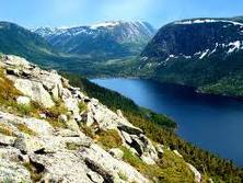
There are many landforms, and waterways in Nova Scotia. Nova Scotia has many bays, coves, small inlets, sandy beaches, and salt water marshes. One common landform in the United States and in Nova Scotia, is the Appalachian Mountains. Cope Breton Island is a part of Nova Scotia, and it is also Canada's 18th largest island. Cope Breton Island is bordered to the North by the highland Bras d' Or, which is one of the world's biggest salt water lakes. Cope Breton is indented on it's eastern coastline, in the North highlands lays the White Hill. The White Hill is Nova Scotia's highest elevation point, with it's highest point being at 532 m (1,745ft). The Margaree and the Mira are the provinces largest rivers, other rivers or streams run into Bras d' Or. The largest fresh-water lake in Nova Scotia is Ainslie.Sable Island is in Halifax(which is the capital of Nova Scotia) and is a sandbar that is about 160 km away from the mainland. Sable island is covered in grass, and is known to be called the graveyard of the Atlantic because many ships had wrecked there. The mainland in Nova Scotia is speckled with many freshwater lakes; the largest of them being Lake Rossignol. Rivers of the mainland also included are The Avon, Clyde, Jordon, Liscomb, Mersey, Philip, Roseway, Sable, Salmon, St. Mary's, and Tusket. Canada and it's provinces do not have quarters like the United Sates, so landforms can't be on a quarter if the province doesn't have one. Nova Scotia is located in the Appalachian region, and is in the Atlantic time zone. Nova Scotia has three subdivisions in it's province. The subdivisions are the Atlantic Uplands, the Nova Scotia Highlands, and the Lowlands.
